Indian Territory with Part of the Adjoining State of Kansas &c. (1866)
- Title
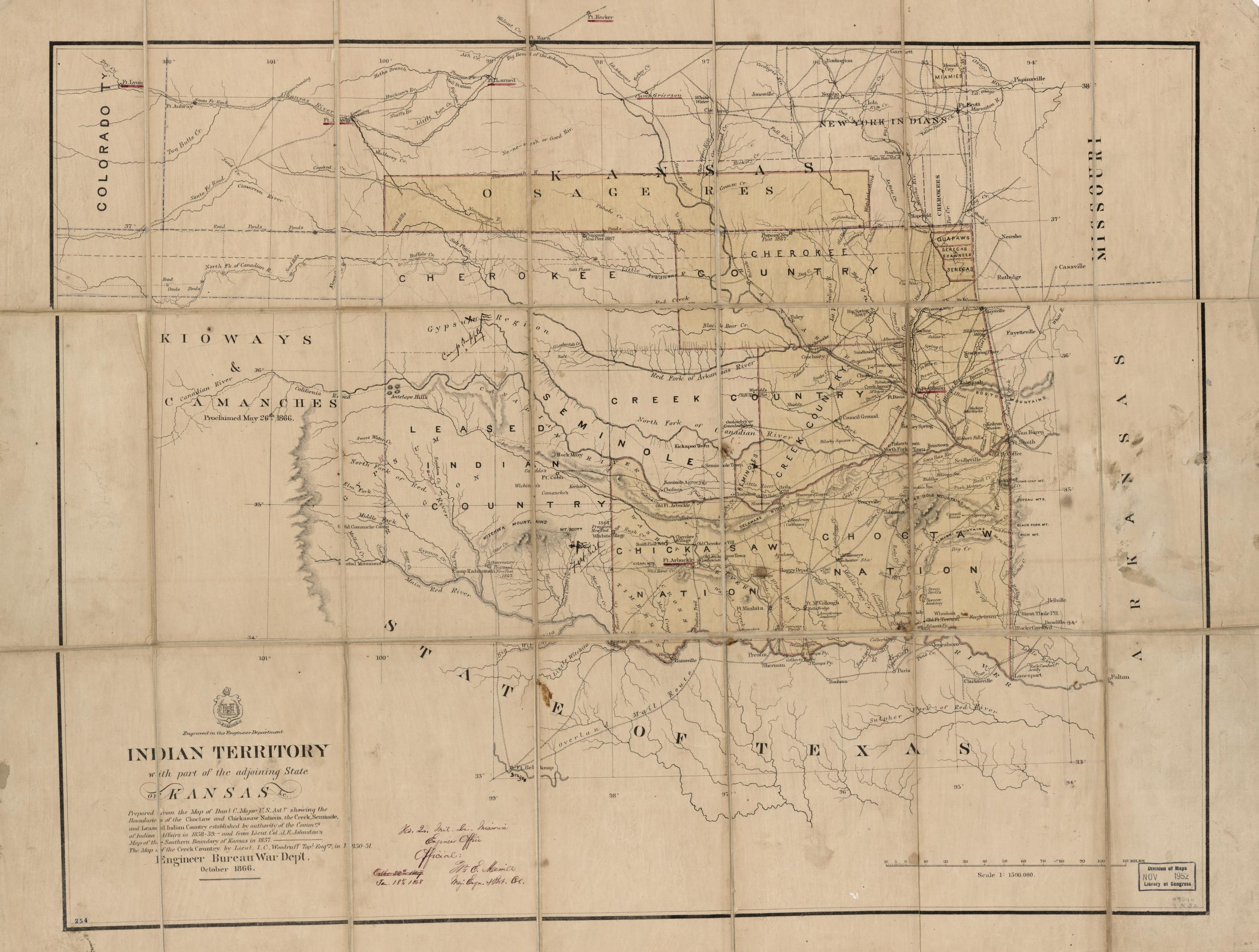
- Indian Territory with Part of the Adjoining State of Kansas &c. (1866)
- Description
- This map shows the treaty-designated territories of the Cherokee, Chickasaw, Choctaw, Muscogee Creek, and Seminole Nations after the conclusion of the Civil War and the signing of each tribe’s 1866 Treaty. Notably, the territories of each nation were significantly reduced.
- Date
- 1866-10
- Document Type
- Image
- Document Category
- Primary Source
- Archival Source
- United States Army. Corps Of Topographical Engineers. Indian Territory with part of the adjoining state of Kansas &c. Washington, D.C.: Engineer Bureau, War Dept, 1866. Map. Library of Congress Geography and Map Division Washington, D.C.
- Digital Repository
- Library of Congress
- Contributor
- Keziah Anderson
- Title
- Indian Territory with Part of the Adjoining State of Kansas &c. (1866)
- Description
- This map shows the treaty-designated territories of the Cherokee, Chickasaw, Choctaw, Muscogee Creek, and Seminole Nations after the conclusion of the Civil War and the signing of each tribe’s 1866 Treaty. Notably, the territories of each nation were significantly reduced.
- Date
- 1866-10
- Document Type
- Image
- Document Category
- Primary Source
- Archival Source
- United States Army. Corps Of Topographical Engineers. Indian Territory with part of the adjoining state of Kansas &c. Washington, D.C.: Engineer Bureau, War Dept, 1866. Map. Library of Congress Geography and Map Division Washington, D.C.
- Digital Repository
- Library of Congress
- Contributor
- Keziah Anderson